![]()
![]()
![]()
![]()
![]()
![]()
![]()
![]()
![]()
![]()

![]()
![]()
![]()
![]()
![]()
![]()
![]()
![]()
![]()
![]()

|
Digimap is a fantastic resource, which I've used with all year groups from 7 - 13. Geographygeek Explorer Trails are supported by Digimap for Schools. You can view the trails here. Here are some instructions for planning a route using Digimaps, made in collaboration with Geogramblings.
|
| KS3 School site survey. This can be easily amended to suit different year groups/schools. Basic instructions to display from Survey123 within ArcGIS. |
 |
|
| KS2 - Africa overview format: .zip/.rar (I also have individual sheets on Malawi, Tanzania, Senegal and Ghana) |
 |
|
KS3 - Brazil Murder Mystery with lesson plan and PowerPoint |
 |
|
KS3 - Flooding in Burton-Upon-Trent with student response sheet and levelled
assessment sheet format: zip/rar |
 |
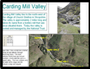
| GCSE - River Study in Carding Mill Valley - all resources included in the zip file |
|